|
|
Tour |
CSIRO intro | copyright | queries | user guide | publications | bug info | data
program code | feedback | search | tour | around the world | workshopsCRCCH
|
|
Tour |
CSIRO intro | copyright | queries | user guide | publications | bug info | data
program code | feedback | search | tour | around the world | workshopsCRCCH
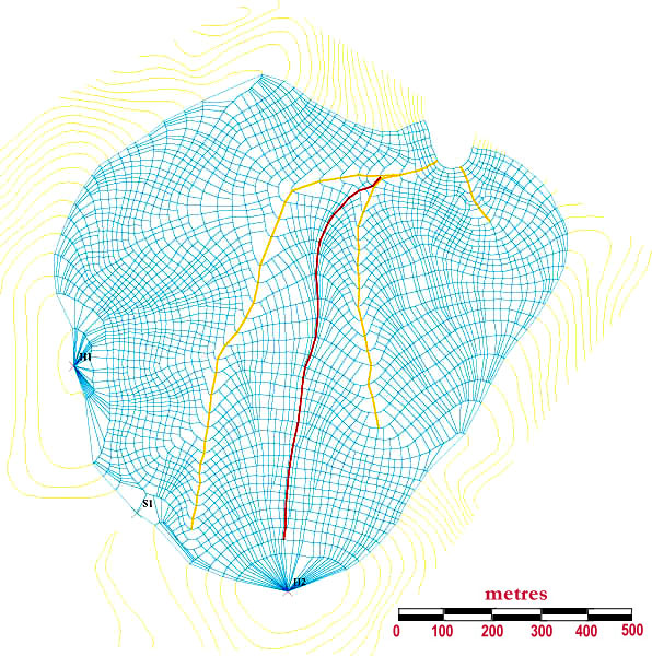
This shows the element network computed by _element. The network amounts to a series of "flow tubes" which diverge or converge according to the shape of the terrain. An element is defined as a cell with an upper and lower contour and a pair of flow trajectories; these are lines of minimum distance between contours. In this example, a 5 m contour interval was used as an average trajectory spacing of 20 m was specified, resulting in a network of 3024 elements. The density of the element network can be altered by changing the contour and trajectory spacing. Normally, we try and achieve an average element size of 20 x 20 m.
OTHER TERRAIN ANALYSIS OUTPUT
raw countour data | digital elevation model contours | boundary calculation | element network
zoom view of element network | aspect | slope | summer radiation
equinox radiation | synthetic hillslopes | topographic indices 1
TOPOG TOUR
last modified onThursday, 29 July 1999