|
|
Tour |
CSIRO intro | copyright | queries | user guide | publications | bug info | data
program code | feedback | search | tour | around the world | workshopsCRCCH
|
|
Tour |
CSIRO intro | copyright | queries | user guide | publications | bug info | data
program code | feedback | search | tour | around the world | workshopsCRCCH
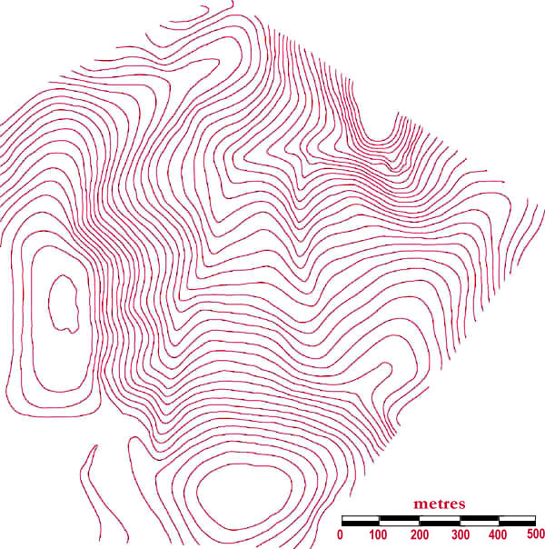
This shows the contours calculated by _grdcon. They span the range 1155-1360 m, using a 5 m contour interval. This data is stored in the .tcn file.
OTHER TERRAIN ANALYSIS OUTPUT
raw countour data | digital elevation model contours | boundary calculation | element network
zoom view of element network | aspect | slope | summer radiation
equinox radiation | synthetic hillslopes | topographic indices 1
TOPOG TOUR
last modified onThursday, 29 July 1999